Menu
Menu
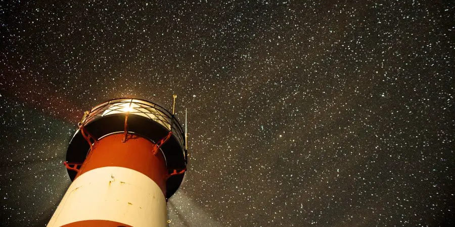
The North Carolina coast has a string of sandy barrier islands. Some of the capes on the coast extend into the waters, making them dangerous to navigate. Laurel Point Lighthouse is one of the towers that were constructed to warn ships about the coast. It is a tower located to the south of the Albemarle Sound. It is in Tyrell County in North Carolina.
Laurel Point Lighthouse was built in 1880. It has a focal plane of 48 feet and a green light flashes from it every four seconds. The original structure showed where the narrower part of the Albemarle began. The tower was a hexagonal screw pile and was demolished in the 1950s. Currently, there is a skeletal tower that is mounted on the original lighthouse’s platform. It carries a square green day mark.
The Laurel Point Lighthouse has a rich history. It is a cultural structure that speaks to the existence of the communities in the region.
In 1868, an inspector of the district submitted a report on the need for a light at the location. The light was to ease navigation through the Albemarle sound. Several petitions were made and signed and the matter was carefully considered by the Board. An estimate was requested and submitted. In 1978, Congress authorized an act for the lighthouse to be constructed. The budget was placed at $25,000. The site was immediately examined and plans to lay the foundation were made.
The tower was built with a mix of wood, metal, and iron. It was made in a hexagonal shape and stood on seven screw piles. A flashing white light was erected on the fourth-order. On January 31, 1880, Laurel Point lighthouse was lit for the first time.
In 1892, a fuel platform was constructed under the tower.
With ice forming in the water in 1893, the seven cast-iron columns that held the tower together broke. The structure shifted slightly due to this and settled on one of the piles. The tower held together remarkably while repairs were organized.
In 1894, a working party was assigned to the tower. They reached aboard the Jessamine in September. The group lay heavy timbers on the horizontal braces and on the piles at the center and around the corners. Support jackscrews and blocks were placed on the braces for strength.
The crew removed the fuel platform, the structure lifted and the broken columns removed. Seven new columns replaced the broken ones and the structure was lowered. The work was painted anew after the fuel platform was returned. The crew also did some general repairs in and around the tower.
The next winter did even more damage to the structure. In October 1895, an inspection was done on the tower. Cracks were found on five of the columns. The structure was pushed out of level. It was built to stand in an inclined position. This forced any attempts to straighten the ironwork to backfire. The tower was headed for collapse. It was then decided to place clusters of heavy wooden piles around the foundation piles. They acted as fenders against the ice. The clusters were of fifteen piles that were secured using iron chains.
There are numerous physical, cultural, and historical features in Tyrell County. If you are looking to explore the county, you are sure to find some interesting gems. Some of the physical features you can visit while in the area are:
There are a number of cultural features in the area. These are the features made and created solely by humans. They include:
Laurel Point Lighthouse was constructed to help ships navigate the Albemarle sound. It was built in 1880 and stood the test of time, only to be defeated by nature. The winters were tough on the structure and forced the foundation to crack and break.
Since the structure was built at an angle, it was difficult to repair it completely and at once. This means that repairs kept breaking and it was not plausible to keep the light functional. After numerous tries, the structure was automated and is not operational.

After getting accepted to ECU, I started looking for things to do in and around Greenville, NC. However, my searches kept taking me to places in South Carolina! There must be things to do around ECU, so I started asking other students. They kept telling me to graduate and move away! This inspired me to begin exploring eastern North Carolina and build this website as a showcase of the places to go, sights to see, and things to do all over eastern NC. I have fallen in love with this region and started taking up roots here. After graduating, I didn't move away - I bought a house here and continue to explore eastern North Carolina.